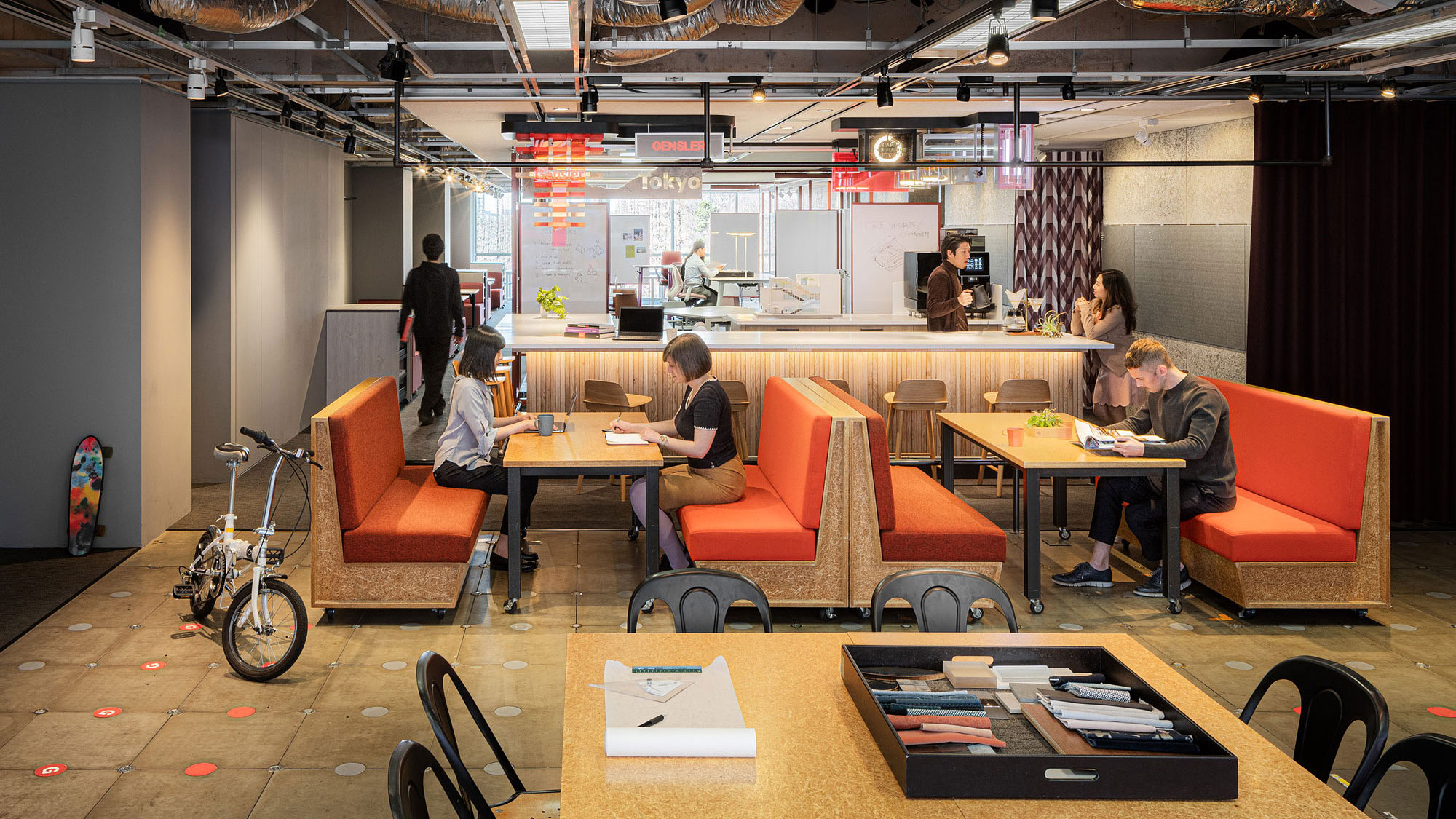
Tokyo
Gensler Tokyo
東京
Gensler 東京オフィス
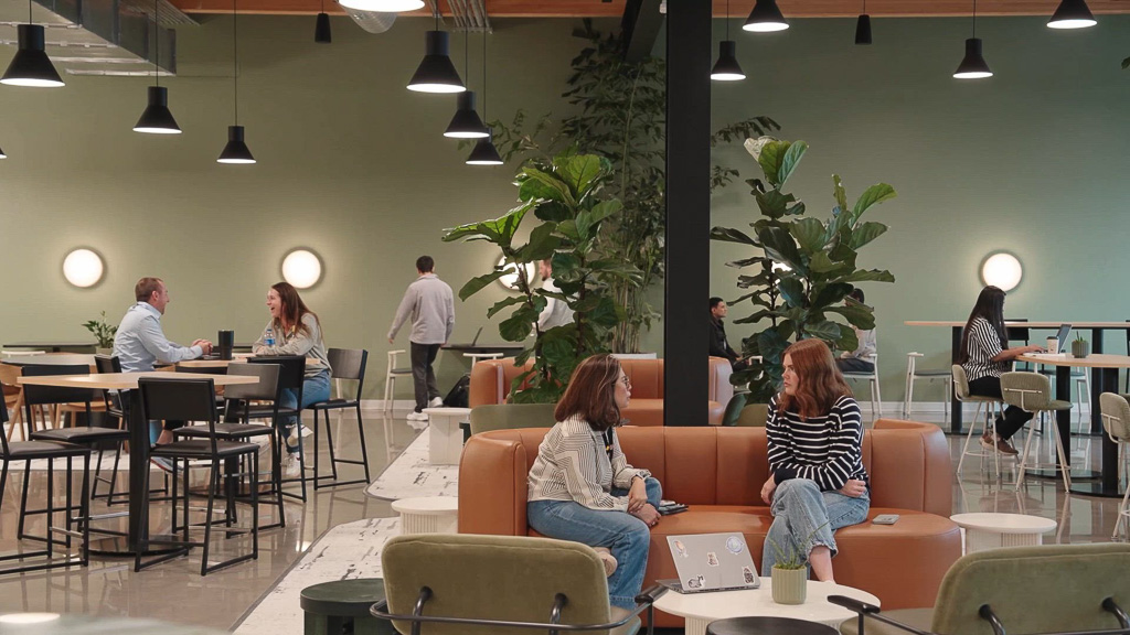
Gensler Tokyo blends design excellence with deep local understanding to create spaces that accelerate future-forward design and embrace Japan’s culture and unique history. Our Tokyo team shapes experiences across workplace, lifestyle, hospitality, and mixed-use environments, inspiring connection, supporting client goals, and driving innovation in every project.
1993年の設立以来、東京オフィスは、グローバルなデザインの知見と日本の都市や暮らしへの深い洞察を融合させ、未来につながる環境づくりに取り組んできました。ワークプレイスからライフスタイル、ホスピタリティ、複合施設に至るまで、幅広い領域で革新的な体験をデザインし、人々に新たなインスピレーションを届けています。
PROJECTS
プロジェクト
54 Items
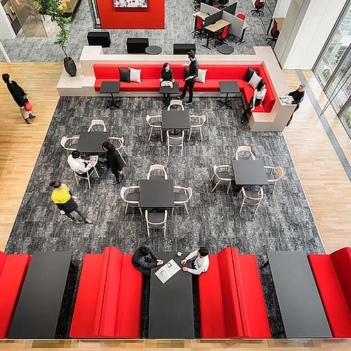
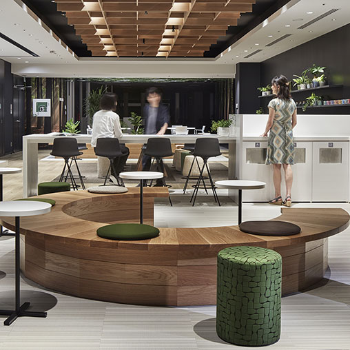
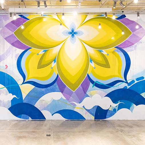
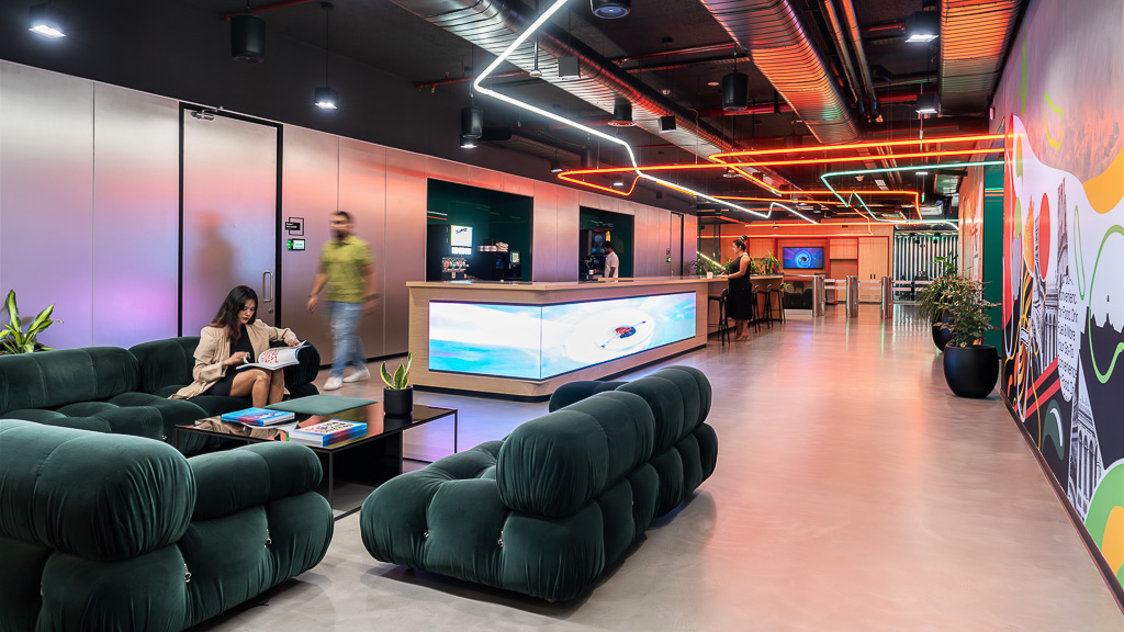
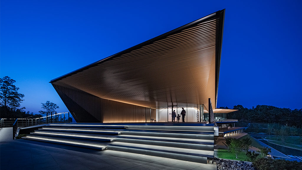
Shiseido
Tokyo, Japan
Shiseido’s transformed headquarters embodies the global beauty company’s new vision — Work x Life x Beauty — by creating an immersive workplace where people can experience the Shiseido DNA.
資生堂
東京都
新しいワークスタイル「Work x Life x Beauty」を体現できる環境を目指し、汐留本社オフィス(GLOBAL VISION CENTER) および資生堂ジャパンオフィスを改修した。ダイバーシティやインクルージョンを推進する開放的な環境と、ブランドDNAを体験できる空間を求めていた。 ゲンスラーは「創...
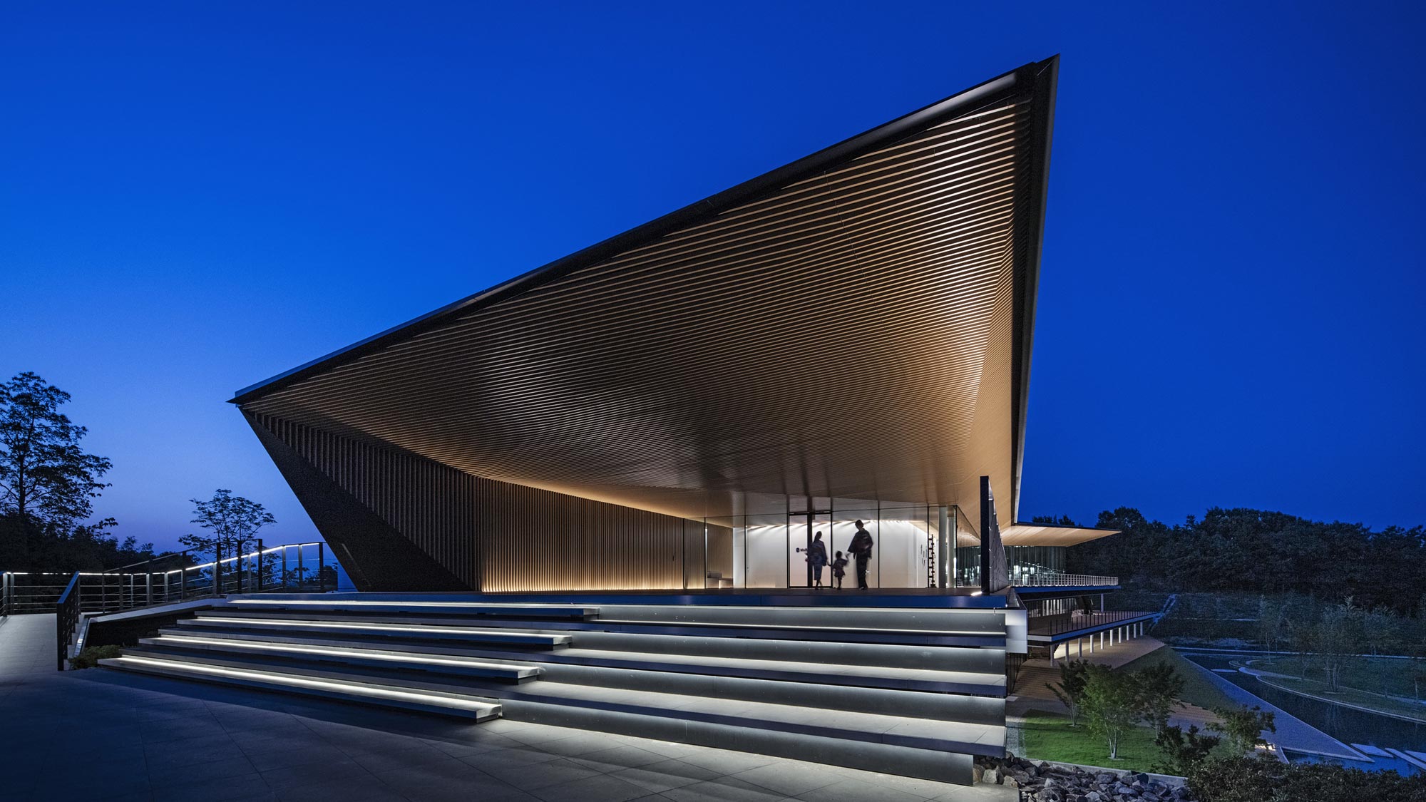
Novotel Nara
Nara, Japan
Novotel Nara invites local and international guests to rediscover Nara’s rich culture with a modern, multisensory design embodying over 1,300 years of the city’s cultural legacy.
ノボテル奈良
奈良県
美しい佐保川沿いに位置し、万葉集にも詠まれたこの場所で、1300年の歴史のある奈良の豊かな文化遺産を五感で再発見する体験を提供するノボテル奈良。 「Reinvent Nara」をコンセプトに、伝統的な日本の要素とモダンな美学が巧みに融合したデザインが印象的なホテルが完成した。
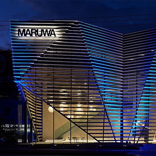
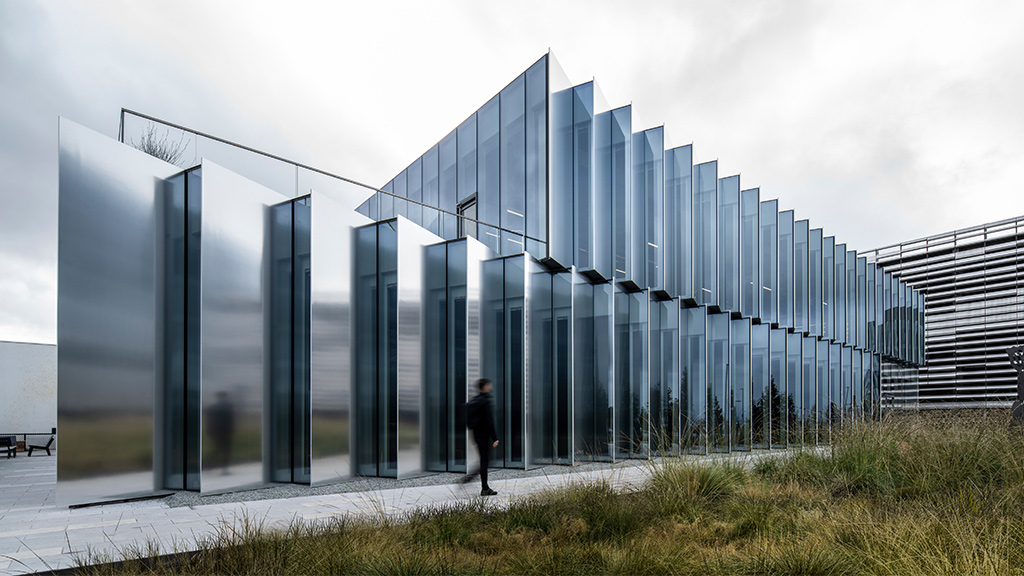
MARUWA Seto Factory
Seto, Aichi, Japan
As a global leader in ceramic materials for electronics, MARUWA partnered with Gensler to transform their Seto, Japan factory into a cutting-edge global hub, revitalizing a site once known for illegal dumping.
Harumi Island Triton Square Office Tower X
Tokyo, Japan
The renovation of Office Tower X at Triton Square, a business hub in Harumi, redefines its waterfront identity, creating a next-generation office building and vibrant destination.
晴海アイランド トリトンスクエア
オフィスタワーX棟
東京都
100年以上の歴史を持つ晴海でビジネスの中心を担ってきたトリトンスクエアのオフィスタワーXを改修。ウォーターフロントのブランドイメージを確立し、人が集まり記憶に残るオフィスビルを目指した。デザインコンセプトは"GATE OASIS"。憩いの場(=オアシス)を通じて、人やビジネスがつながる環境を創出した...
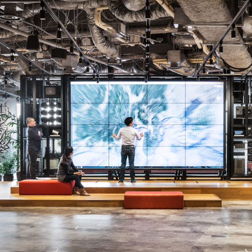
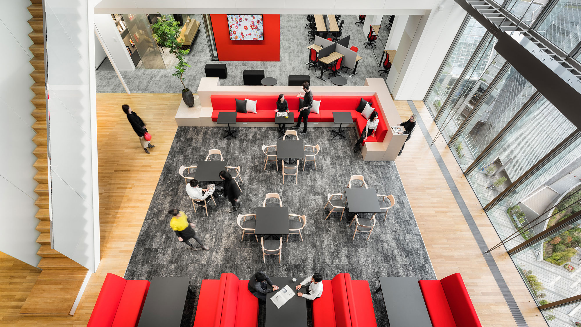
Accenture Innovation Hub Tokyo
Tokyo, Japan
Accenture’s Tokyo Innovation Hub is an experience-driven, state-of-art facility where employees collaborate with clients to turn new ideas into reality.
アクセンチュア・イノベーション・ハブ東京
東京都
日本から発信するイノベーションを生み出す場として開設した、アクセンチュア・イノベーション・ハブ東京。施設の玄関口である8階は、顧客、研究者、起業家など様々なコラボレーターと協働、共創する場として、人々が偶発的に集まる「界隈」と位置づけた。街をテーマにしたオープンスペースには、共創のシンボルとして「櫓やぐら」を設置...
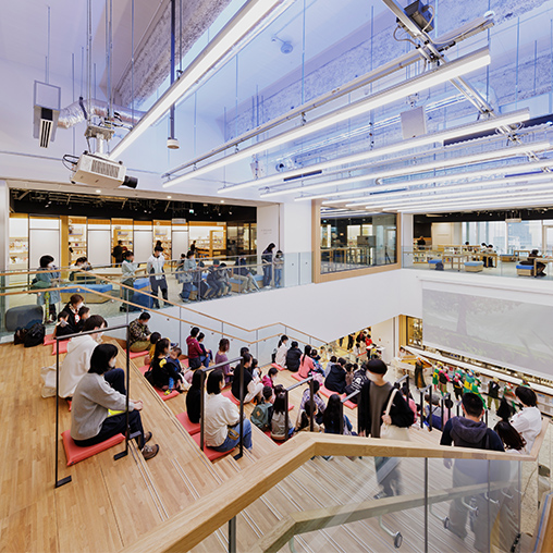
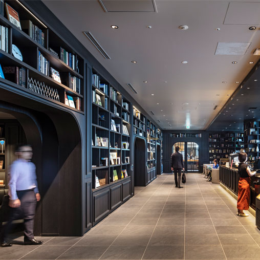
Toyohashi City Library
Aichi, Japan
Toyohashi City Library is a new destination for the community that revitalizes the city centre and offers a space where citizens of all ages want to gather.
豊橋市まちなか図書館
愛知県
豊橋市の中心市街地活性化に向けた取り組みの一部として、駅前の再開発複合ビルに入居する「まちなか図書館」。コンセプト作りから内装デザインまでを担当したゲンスラーは、あらゆる世代の図書館利用者が集いたくなるような空間をデザインした。
目指したのは、館内に響き渡る音楽や子どもたちの歌声がコミュニティの輪を広げ、世代を...
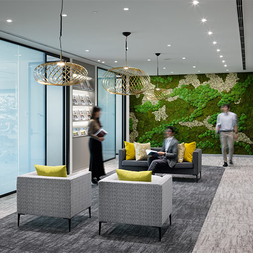
Baycurrent
Tokyo, Japan
The Baycurrent headquarters embodies a borderless and inclusive concept by eliminating psychological and physical barriers, creating an accessible space for all.
ベイカレント
東京都
本社移転プロジェクトでは、「Borderless & Inclusive」をコンセプトに、部門や社員の垣根をなくし、誰もが直感的に使いやすく、快適に働けるオフィスを実現。人の体験を軸に、ホテルのような快適さと上質なサービスを備えた、ホスピタリティの高いワークプレイスを目指した...
Hyatt House Kanazawa
Ishikawa, Japan
Inspired by the design concept of Kaga-ism, the Hyatt House Kanazawa hotel reflects the local Hokuriku area lifestyle, craftsmanship, and aesthetic senses, along with a way of living in harmony with nature.
ハイアットハウス金沢
石川県
北陸初のハイアットとして注目される中長期滞在向けホテル「ハイアットハウス金沢」が求めていたのは、文化創造都市・金沢の上質な暮らしを体験できる空間であった。ゲンスラーは、加賀の時代より培かわれてきた金沢の暮らしを象徴する「加賀イズム」をデザインコンセプトとし、金沢町屋の暮らし、職人の技と美意識、そして自然との共存を...
SAP Group
Tokyo, Japan
SAP’s new Tokyo office adds to SAP’s campus ecosystem that accelerates innovation and collaboration with clients and partners and supports hybrid work.
SAPグループ
東京都
SAPが掲げたビジョン「Pledge to Flex(プレッジ・トゥ・フレックス)」に基づき、スタッフがより柔軟な働き方ができる新オフィスが東京にオープンした。 既に大手町に存在するExperience CenterとInspired.Lab、そして東京の新オフィスを加えた3拠点をキャンパスとして捉え、クライアン...
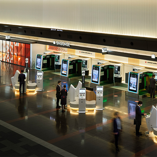
Japan Airlines Check-In Area
Multiple Locations, Japan
Gensler designed the departure lobby of JAL’s domestic airports, including Haneda, Shin-Chitose, Itami, Fukuoka, and Okinawa.
日本航空株式会社 チェックインエリア
国内複数拠点
日本航空が「JAL SMART AIRPORT」の実現を目指して国内で順次展開しているチェックインエリアの改修プロジェクト。「ストレスフリーな空の旅」をテーマにしたスマートチェックイン採用に伴い、ゲンスラーは羽田、新千歳、伊丹、福岡、沖縄の国内5拠点で一般エリアのデザインアップグレードを手掛けた。 日本の玄関口...
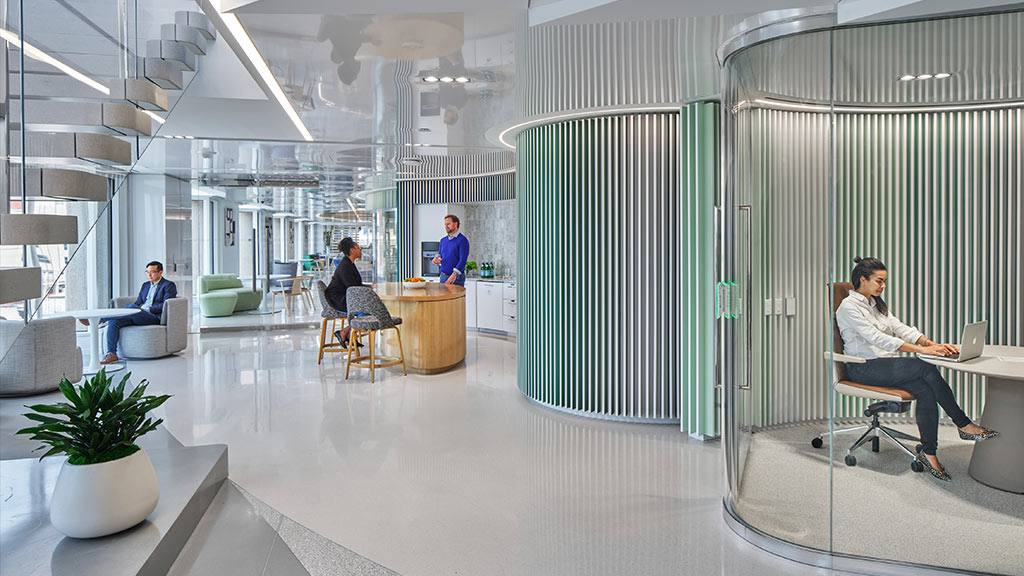
Bristol Myers Squibb
Tokyo, Japan
Biopharmaceutical firm Bristol Myers Squibb sought to transform its work culture with Gensler Tokyo’s interior design and change management services.
ブリストル・マイヤーズ スクイブ
東京都
バイオファーマ製薬企業、ブリストル マイヤーズ スクイブ社はオフィスの統合移転を機に、新しい働き方の具現化を目指した。ゲンスラーはインテリアとチェンジマネジメント業務を担当し、BMS社の信念である「Innovation with Heart( 心のこもったイノベ ーション)」を実現するためのオフィス構築を支援した...
BizFlex
Multiple Locations, Japan
Drawing on its knowledge of the rental office business, Hulic launched “Bizflex”, a new series of medium-sized flexible workplace projects.
Bizflex
国内複数拠点
ヒューリック社が長年の賃貸オフィス事業で培った知見を活かして、新たにシリーズ展開を開始した中規模フレキシブルオフィス事業「Bizflex」。 サブスクリプション、ワークプレイス、オフィスDXの3つをコンセプトとし、短期利用やコスト効率を求める企業が柔軟に入居できる、家具・内装を備えた賃貸オフィスとなっている。ゲン...
Confidential Software Company
Tokyo, Japan
To signify this software company’s introduction to the Japanese market, a distinctive maritime theme is woven throughout its new branded workplace in Tokyo.
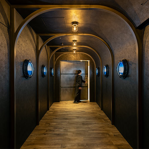
コンフィデンシャルソフトウェア会社
東京都
某ソフトウェア会社の東京オフィス拡張にあたり、企業ブランドが感じられると同時に、より生産性の向上につながるワークプレイス作りを目指した。
日本市場への参入を象徴したユニークなデザインコンセプトはMaritime(海洋)。入港する船内を表現した通路を抜けると、明るいレセプションと広々としたカフェエリアがゲストを迎...
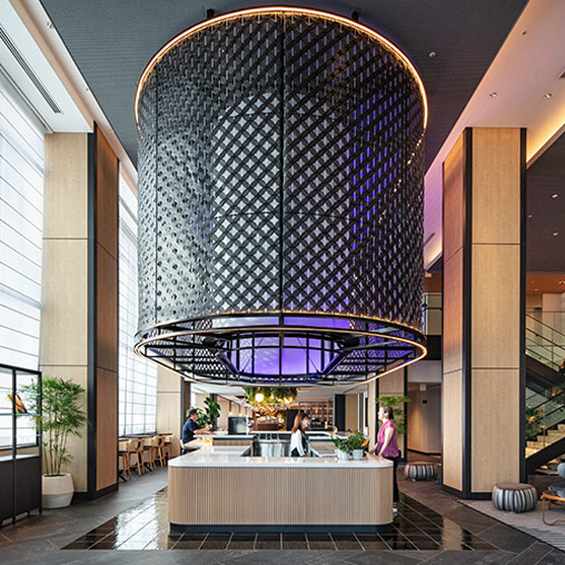
THE GATE HOTEL TOKYO
Tokyo, Japan
The Gate Hotel Tokyo, designed by Gensler, creates a sense of unity with the outside environment with four outside terraces unique in the Ginza area
ザ・ゲートホテル東京
東京都
ザ・ゲートホテルは、「自分自身と街の間の境界線を超えるGateのようなホテル」と銘打った、インティメイト(親密な)をブランドコンセプトにしたライフスタイルホテル。浅草につづき、2軒目となるザ・ゲートホテル東京もまた、ローカルな銀座エリアの魅力を存分に感じられる仕掛けに満ちている。 街とのつながりを意識し、銀...
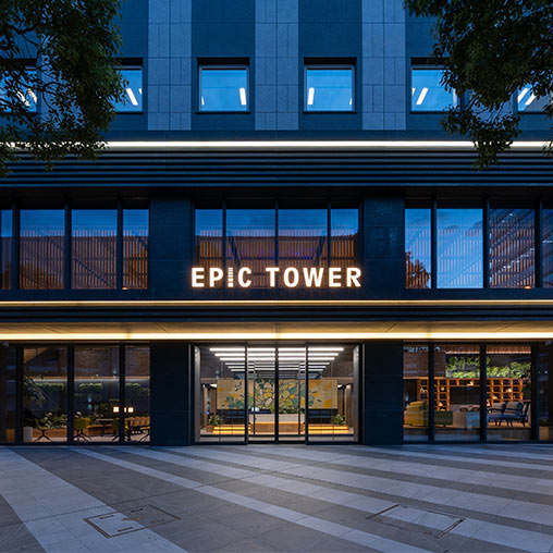
Epic Tower Shin Yokohama
Kanagawa, Japan
Gensler helped to transform the property into an environment that accommodates multiple tenants and can serve as a “third place” and extension of the workplace.
エピックタワー新横浜
神奈川県
一つの企業によって使われていたオフィスビルを、複数のテナントが入居できるビルに転換させるべく、共用スペースを改修したプロジェクト。地域で最高レベルのオフィスビルを目指し、あらゆる利用者にとっての’サードプレイス’となるように空間をアップグレードさせた。
出入り口として通り過ぎるだけの空間であったエントランスロビ...
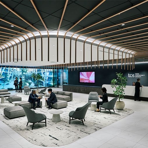
Tata Consultancy Services Japan
Tokyo, Japan
At its relocated headquarters, TCS Japan aimed to position itself as a gateway connecting its capabilities with global clients through a dynamic customer experience area.
日本タタ・コンサルタンシー・サービシズ
東京都
日本TCSの東京本社移転プロジェクト。この拠点は、TCSが世界中の企業との変革を通じて築いたケイパビリティとクライアントをつなぐゲートウェイとして位置づけられ、1フロアに執務エリアと国内外のイノベーションやサービスを体験できるカスタマーエリアを併設した。 日本TCSのビジョン「Gateway to...
_Edited_508x508_1519229287_508x508.jpg)
Nomura Research Institute
Multiple Locations, Japan
Nomura Research Institute, a leading global provider of system solutions and consulting services, relocated their headquarters and consolidated the regional...
野村総合研究所
国内複数拠点
社員の多様性や健康に配慮しながら、新しい価値や知的資産を生み出す次世代のオフィス構築を目指した野村総合研究所は、東京本社移転および横浜地区と大阪地区の大規模移転プロジェクトをそれぞれ遂行した。 ゲンスラーはワークプレイスコンサルティングとインテリアデザイン業務を通じて、オープンコミュニケーション型オフィスの構築を...
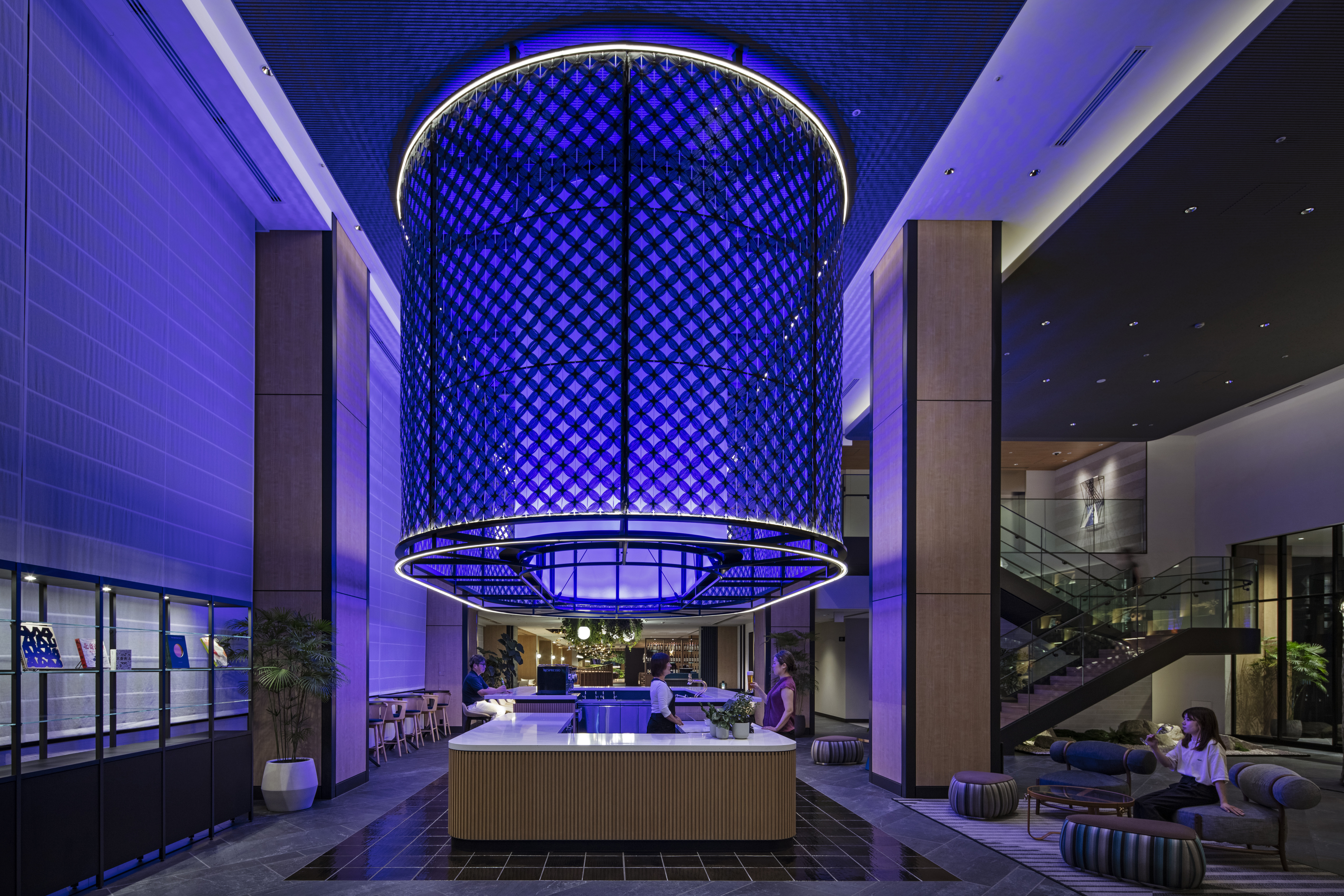
Sotetsu Hotel The Splaisir Yokohama
Kanagawa, Japan
Sotetsu Hotels’ The Splaisir brand marks its first domestic opening in this new 221-room hotel located in Kanagawa, Japan.
相鉄ホテルズ ザ・スプラジール 横浜
神奈川県
国内初の「相鉄ホテルズ _ザ・スプラジール」ブランドとして登場したこのプロジェクトは、221室の宿泊特化型ホテル。「綴る」をコンセプトに、横浜の歴史とホテルブランドの世界観が融合したデザインを実現した...
MARUWA R&D Center
Aichi, Japan
MARUWA, a company that manufactures ceramics for electronic components, worked with Gensler Tokyo to design its new factory and R&D Center.
株式会社Maruwa R&Dセンター
愛知県
愛知県からグローバルにシェアを展開するセラミック素材メーカー、MARUWAのR&D(研究開発)センター新築プロジェクト。土を扱う窯業からセラミック精密素材をつくるメーカーへ進化した企業であることから、R&Dセンターでは、新しい価値を「掘り起こす」ことと掛けてコンセプトを「Innovation Mi...
Freshfields Bruckhaus Deringer
Tokyo, Japan
This global law firm’s Tokyo office relocation created the opportunity for Gensler to design a professional and wellbeing-focused workplace to support workers.
フレッシュフィールズブルックハウスデリンガー
東京都
国際法律事務所の東京事務所移転に伴い、ゲンスラーは、弁護士・所員・ゲストにとって、プロフェッショナル且つウェルビーイングで快適なオフィス環境つくりを目指した。
「ビジネス・ホスピタリティ」をテーマにデザインされたクライアントエリアは、苔のグリーンウォールを配した、自然光溢れるロビーラウンジとした。ロビーに隣接す...
Shintora-Dori CORE
Tokyo, Japan
Shintora-Dori Core, a new mixed-use building, opened in an evolving area in Tokyo, Toranomon.
新虎通りCORE
東京都
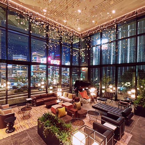
東京の新たなシンボルストリートとして注目される新虎通りにオープンした、複合施設「新虎通りCORE」。街の賑わいと交流を創出する拠点として、最新スペックのオフィス、600 ㎡ 超のインキュベーションオフィス、レストランが入居する。ゲンスラーは、その施設に誕生したカフェ・ダイニングと大型イベントスペースが融合したクリ...
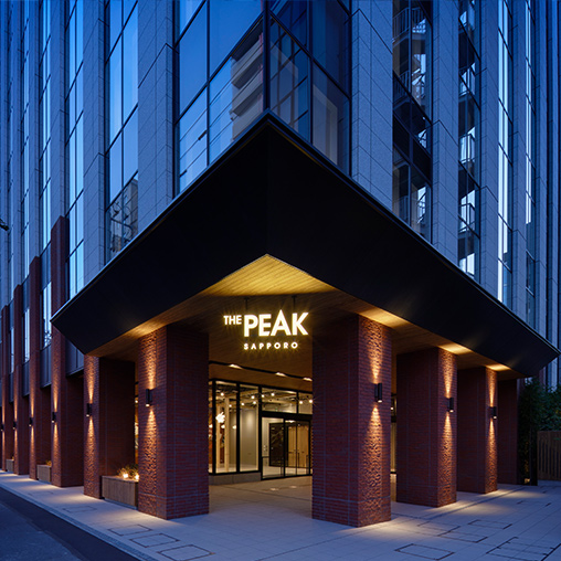
The Peak Sapporo New Office Building
Hokkaido, Japan
Located in the central district of Sapporo, The Peak is an office building that offers communal lounges and a top floor terrace space for people to relax.
The Peak Sapporo
北海道
札幌の中心部に新しく完成したオフィスビル「THE PEAK Sapporo」の、ファサードから内装デザイン、アートコーディネーション、ロゴデザイン、ネーミングまでを手掛けたプロジェクト。 「札幌で一番居心地のいいオフィスビルを目指す」というテーマから、ファサードやロゴはトップ=山をモチーフにしたデザインとした。...

Nikko Style Nagoya
Aichi, Japan
Gensler oversaw the interior and brand design of Nikko Style Nagoya, the first lifestyle hotel brand by Okura Nikko Hotels. As the demands and preferences of the guests become diverse, the design concept, intends to spark curiosity for guests to discover a lifestyle that suits them during their stay
ニッコースタイル名古屋
愛知県
「スタイルと出会う」をデザインコンセプトに、ゲンスラーはオークラニッコーホテルズが手掛ける初のライフスタイルホテルブランド、ニッコースタイル名古屋のインテリア及びブランドデザインを担当した。 ゲストの多様化する価値観に応えるべく、それぞれが新しい自分のスタイルを発見できるような、好奇心を刺激するスペースとした。
...
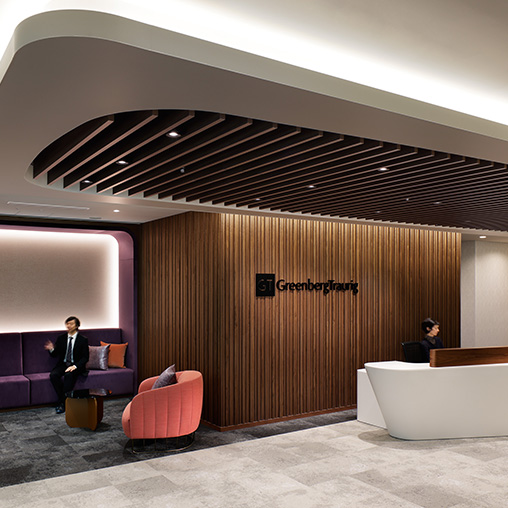
Greenberg Traurig
Tokyo, Japan
To support Greenberg Traurig’s Tokyo office relocation, Gensler created a workplace design tailored to the international law firm featuring a modern Japanese theme.
グリーンバーグ・トラウリグ法律事務所
東京都
法律事務所、グリーンバーグ・トラウリグの日本における拠点の事務所移転プロジェクト。ゲンスラーはモダンな日本らしさをテーマに、プロフェッショナルサービスファームに相応しいワークプレイスをデザインした...
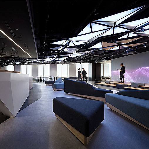
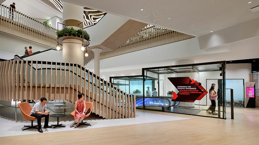
Ridgelinez
Tokyo, Japan
Gensler led the workplace design strategy as well as interior design and digital content creation at the new offices of Ridgelinez, a company committed to...
Ridgelinez
東京都
顧客企業のデジタルトランスフォーメーション(DX)を実現する「Ridgelinez(リッジラインズ)」設立にあたり、ゲンスラーは新規オフィスのワークプレイス戦略からインテリアデザイン、デジタルコンテンツ作成業務を担当。 包括的なデザインを通して“デジタル技術を活用した変革支援を創造するオフィス”を構築した。 来...
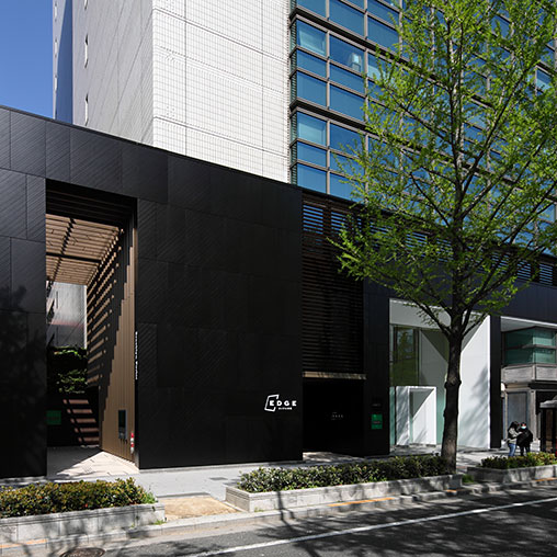
EDGE Shinsaibashi Building
Osaka, Japan
Beyond simply renovating and repositioning the building, Gensler saw an opportunity to improve its overall performance and create retail space on the ground...
EDGE心斎橋ビル
大阪府
大阪心斎橋に位置する複合商業施設ビルのポテンシャルを最大限に引き出す為、意匠面・機能面の両面におけるアップグレードが求められていた。 立地から、事務室用途よりも商業用途としての貸付けが、事業収益上優位であると考え、サービス系テナントの入居をも視野に入れた基準階の事務所フロアと、低層階の商業フロアの双方が共存できる...

Fujitsu
Tokyo, Japan
Gensler Tokyo transformed the Fujitsu executive floor to create a more communicative environment for staff and executives. The Tokyo headquarters now holds a flexible space to support various work styles.
富士通株式会社
東京都
社員・役員同士がよりコミュニケーションのとりやすい環境を目指して改修された本社オフィス内の役員フロアは、フレキシブルに多様なワークスタイルをサポートできる空間に生まれ変わった。 フロアは、秘書を含めて誰でも働けるオープンなワークラウンジが広がる。集中作業用のデスク、気軽に打ち合わせができるテーブル、フォンブース...
REGIONAL LEADERSHIP
地域のリーダーシップ

David J. Calkins
Co-Regional Managing Principal
David Calkins is the Co-Regional Managing Principal of Gensler’s Asia Pacific and Middle East (APME) region.
デイビット・J・カルキンズ
コーリージョナルマネージングプリンシパル
| リンクトイン »
ゲンスラーのアジア太平洋・中東(APME)地域のリージョナル・マネージング・プリンシパル。シニアマネジメントチームをリードし、APMEにおける成長戦略やクライアントリレーションを統括する。テクノロジーから科学、ホスピタリティ、住宅、リーテイル、そしてオフィスビルまで多くの実績と受賞歴を持つ建築家でありながら、マネジメント委員会のメンバーも務める。 ま...

Theresa Sheils
Co-Regional Managing Principal
Theresa Sheils is the Co-Regional Managing Principal of Gensler’s Asia Pacific and Middle East (APME) region.
OFFICE LEADERSHIP
オフィスのリーダーシップ
Jo Suganuma
Representative in Japan, Managing Director, Principal
Jo Suganuma is the Representative in Japan of Gensler’s Tokyo office, with over 20 years of experience with international and local projects.
菅沼 丈
日本における代表、プリンシパル
プロジェクトマネジメントと建築両方の分野で20年以上にわたって培ってきた経験をもとに、日本における代表として、クライアントリレーションシップやチームとのコミュニケーション、そしてプロジェクトの遂行に尽力する。ワークプレイスディレクターや、アジアパシフィック地区におけるクライアント・リレーションシップリーダーを歴任し、洞察に富んだ戦略と革新的なデザインソ...
LEADERSHIP
リーダーシップ

Daichi Amano
Creative Director, Principal
Daichi Amano is a Creative Director at Gensler Tokyo, celebrated for his extensive expertise in creative strategy and profound understanding of market trends.
天野 大地
クリエイティブディレクター、プリンシパル
エクスペリエンスデザインや戦略構築を推進する、クリエイティブディレクター。建築やインテリア、デジタルメディア、ブランドデザインまで多岐に渡る経験とグローバルな知見を活かし、フィジカルとデジタルを掛け合わせた、新たな体験を得られる環境を提案する。ユーザーが求める体験とそれを実現する環境の可能性を追求し、エクスペリエンスを軸に戦略を組み立てる。独創的かつ先...

Sarah Bader
Co-Regional Client Relationship Leader and Executive Director, Principal
As Co-Regional Client Relationship Leader and Executive Director at Gensler, Sarah Bader leads local and global teams in crafting design solutions for clients.
Masashi Kato
Studio Director, Principal
As Lifestyle Studio Director in Gensler Tokyo, Masashi Kato brings extensive expertise in working with a wide range of clients across diverse project types.
加登 雅
スタジオディレクター、プリンシパル
ニューヨークでデザイナーとしてキャリアをスタートさせ、オフィスやホスピタリティ、リテールなど、幅広い分野のプロジェクトを多数経験。アメリカでの設計・施工監理経験を活かした創造的なアイデアと戦略的な施策を通じて、デベロッパーやインベスターをはじめとしたあらゆるクライアントに価値を提供し続ける。設計からグラフィック、ブランドデザイン、ストラテジーまで、多様...

Chie Matsushita
Design Director, Principal
As Design Director and workplace design expert, Chie Matsushita oversees and leads the design culture within Gensler’s Tokyo office.
松下 千恵
デザインディレクター、プリンシパル
ワークプレイスプロジェクトを中心に、ホテルからトレーニング施設まで幅広くプロジェクトを手がけてきたデザインディレクター。社員の働き方分析からプログラミング、設計監理までのすべてのフェーズにわたってデザインチームをリードし、ユーザーにとって機能的かつ効果的な環境デザインを提案する。プロフェッショナルサービス企業分野においてはゲンスラーアジア地区のリーダー...

Masayuki Kobayashi
Studio Director
Masayuki Kobayashi is a Studio Director specializing in workplace projects, who excels in communicating with clients, consultants, and contractors of all sizes.
小林 雅幸
スタジオディレクター
国内外のプロジェクトを通して設計とプロジェクトマネジメントの両分野で経験を積んだ後、ゲンスラーに入社。ワークプレイスを専門に手掛けるスタジオのディレクターとしてチームを牽引し、グローバルに活躍する企業のプロジェクトに多数携わる。戦略段階から設計、完了までプロジェクト全体を通してチームワーク重視のアプローチをとり、異なる専門知識を持つチームメンバーとコン...

Masayuki Tanaka
Studio Director
As Studio Director in Gensler’s Tokyo office, Masayuki Tanaka effectively harnesses technical expertise to deliver exceptional design solutions with his team.
田中 雅之
スタジオディレクター
建築的な専門知識と、卓越したデザインソリューションを提供するチームを率いるスタジオディレクター。プロジェクトブリーフの作成から設計期間、現場での調整まで、プロセス全体を通して探究心を持ってプロジェクトをリードする。プロジェクトゴールに対しての効果的なデザインの実現、チームワークや生産性の向上 ー その双方を両立させるテクノロジーや手法を採用することで、...

Haruka Yokokawa
Studio Director
Haruka Yokokawa is a Studio Director in Gensler’s Tokyo office who guides a team in developing and executing creative strategies rooted in digital experience and brand expression.
横川 遥
スタジオディレクター
デジタル制作プロダクションおよびクリエイティブエージェンシーにて、多様なデジタルプロジェクトに携わってきた実績を持つデザインマネジャー。デジタルエクスペリエンスおよびブランド表現を軸に、クライアントのビジネス課題を解決するクリエイティブ戦略を立案・実行するスタジオのディレクターも務める。

Tatsuhito Koike
Studio Director
Tatsuhito Koike is a Studio Director in Gensler’s Tokyo office who leads workplace projects with a strategic and holistic mindset.
小池 達仁
スタジオディレクター
ワークプレイス分野のプロジェクトを牽引するスタジオのディレクター。多分野のデザイナーやストラテジストが連携する統合チームをリードし、ホリスティックな視点でプロジェクトを推進する。業界で培った豊富な経験をもとに、クライアントの潜在的な課題を的確に捉え、デザインマネジメントの観点から戦略的に解決する。クライアントとの対話を重ねながら、ビジネスの成長につながる価値の創出に力を注いでいる。
NEWS
ニュース
In The Media
![]() Forbes
Forbes
Forbes Recognized Gensler on Its 2026 List of America’s Best Employers for Company Culture
Forbes honored Gensler for the second year in a row, based on a survey of more than 217,000 U.S. employees at companies with at least 1,000 U.S. employees.
Press Release
Gensler Expands Sports & Entertainment Leadership, Strengthening Presence Across Asia Pacific & Middle East
Elliott Pears steps into a new role, driving the next chapter of sports and entertainment design across the APME region.
Recognition
![]() IIDA
IIDA
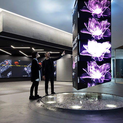
Icon Place Shibakoen
2025 Best of Asia Pacific Design Awards Winner, Public Spaces and Commercial Lobbies Category
In The Media
![]() IDA
IDA
IDA Recognized Gensler’s Transformation of Icon Place Shibakoen With a 2025 Gold IDA Award
Blending harmoniously with the surrounding streets of Tokyo, the Gensler-designed Icon Place Shibakoen aims to connect people and community.
Recognition
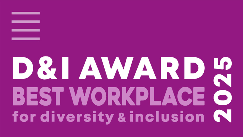
![]() D&I Award
D&I Award
Gensler Tokyo
D&I Award recognized Gensler Tokyo with the D&I Award 2025 for Best Workplace for the third consecutive year, underscoring our commitment to fostering a diverse and inclusive workplace culture that drives innovation and positive change.

In The Media
![]() Architecture & Design
Architecture & Design
Aviation Leadership Appointment Signals Expansion of Gensler’s APME Practice
Max Connop was appointed Aviation Leader for Gensler’s APME region, leading the practice’s growth and delivering airport solutions that enhance passenger experience and support decarbonization.
Recognition
![]() Nikkei New Office Award
Nikkei New Office Award
Nikkei New Office Award
Komatsu Wall 101 Tokyo Showroom Office & ABeam Consulting Headquarters Office received the Nikkei New Office Award for 2025.
Recognition
![]() Nikkei New Office Award
Nikkei New Office Award
第38回日経ニューオフィス賞
小松ウオール 101 TOKYO SHOWROOM OFFICEとアビームコンサルティング本社オフィス 第38回日経ニューオフィス賞ニューオフィス推進賞とクリエイティブ・オフィス賞を 受賞しました。
In The Media
![]() InDesign Live
InDesign Live
InDesign Live Featured a Podcast Interview With Digital Experience Design Leader Robbie Robertson
Robertson, based in Gensler’s Asia Pacific and Middle East region, discussed technology, AI, and human-centered design. Listen to the episode.
In The Media
![]() Interior Design
Interior Design
Gensler Ranked #1 on Interior Design’s 2025 Top 100 Giants List
Gensler was also voted the Most Admired Firm by our peers.

In The Media
![]() ZAWYA
ZAWYA
Theresa Sheils Has Been Appointed Co-Regional Managing Principal for Gensler’s APME Region
Theresa Sheils will partner with David Calkins to drive growth in Gensler’s Asia Pacific Middle East (APME) region.
In The Media
![]() Southeast Asia Building Magazine
Southeast Asia Building Magazine
The Rapid Growth and Challenges of Smart Cities in Asia
Gensler Regional Managing Principal David Calkins discussed how innovative developments and strategies are shaping the future of urban living.
 Southeast Asia Building Magazine
Recognition
![]() Urban Land Institute
Urban Land Institute
Urban Land Institute
MARUWA Seto Factory, designed by Gensler with Takenaka Corporation, was recognized as a winner of the 2024 ULI Asia Pacific Awards for Excellence.
Recognition
![]() Urban Land Institute
Urban Land Institute
ULIアジアパシフィックアワード
株式会社MARUWA瀬戸工場プロジェクトが2024 ULI Asia Pacific Awards for Excellenceを受賞しました。
In The Media
![]() Fast Company
Fast Company
Fast Company Covered Key Findings From Gensler’s 2024 Global Workplace Survey
The survey polled over 16,000 office workers about how they are using the office today. Global Workplace Research Director Janet Pogue McLaurin explained the top factors driving high-performing workplaces.
INSIGHTS
インサイト
Design Forecast 2026
Geo-Trends: Japan
Explore the design trends shaping Japan to meet growth and new needs across workplaces, industrial infrastructure, data centers, hospitality, senior living, and more.
Design Forecast 2026
Geo-Trends: Japan
Explore the design trends shaping Japan to meet growth and new needs across workplaces, industrial infrastructure, data centers, hospitality, senior living, and more.
Design Forecast
Design Forecast 2026
Gensler’s Design Forecast 2026 explores the top global design trends and strategies shaping the future of the built environment. With insights, research, and projects across 33 practices, we help clients elevate the human experience.
Research
Global Workplace Survey 2025
Gensler’s Global Workplace Survey 2025 reveals the importance of in-person work and insights on how workplaces can be better designed to support all forms of work for individuals and teams.
Sustainability
Resilience by Design
Our Resilience by Design Report presents solutions for transforming the built environment to achieve a net zero carbon impact across our portfolio and the design industry.
Research
Global Workplace Survey 2026
This research explores how people work today, how the biggest users of AI reveal emerging behaviors, and how an increased focus on learning and connection is redefining the value of the workplace.
Design Forecast 2026
6 Trends Shaping Design in 2026
Discover the most important and actionable themes shaping design in 2026, based on over 100 trends across 33 industries around the world.
Blog
Why Japan’s Workplace Trends Are Moving Against the Global Current
How companies in Japan can adapt their workplace solutions to counteract the country’s stagnating office experience.
Blog
Six Decades of Creativity: Interior Design Magazine Celebrates Gensler’s 60th Anniversary
The industry publication marks a milestone in the firm’s history with a roundup of global projects and people shaping what’s next in design.
Blog
Designing Workplaces That Work — With Your People
When employees are involved in the planning and design process, the workspaces we create are more effective, engaging, and human.

Research
City Pulse 2025
Gensler surveyed 33,000 people across 65 cities to uncover what makes a city magnetic — how it attracts new residents and keeps them wanting to stay.
WEBINAR
Experience Design Trends 2025
Gensler’s Global and APME Digital Experience Design, Strategy, and Brand leaders explore top trends for 2025 in Experience Design.
Design Your Career With Us
We grow our firm by growing our people — we invite you to search for opportunities and explore how you can reimagine the future with us.
Gensler Tokyo
METLIFE Aoyama Bldg 2F
2-11-16 Minami Aoyama
Minato-ku, Tokyo
107-0062 Japan
Tel: 03.6863.5300
2-11-16 Minami Aoyama
Minato-ku, Tokyo
107-0062 Japan
Tel: 03.6863.5300
Gensler 東京
〒107-0062
東京都港区
南青山2-11-16
METLIFE青山ビル2F
Tel: 03.6863.5300
東京都港区
南青山2-11-16
METLIFE青山ビル2F
Tel: 03.6863.5300